More on Colorado/New Mexico Earthquake

Unusually strong earthquake in Colorado / New Mexico, United States – Roads have been damaged

Last update: August 23, 2011 at 2:11 pm by By Armand Vervaeck and James Daniell

Earthquake overview : After having experienced a foreshock with a magnitude of 4.6 at 5:30 PM on August 22, a second strong mainshock measuring 5.3 magnitude (5.5 initially reported)  scared the Trinidad, Raton area.

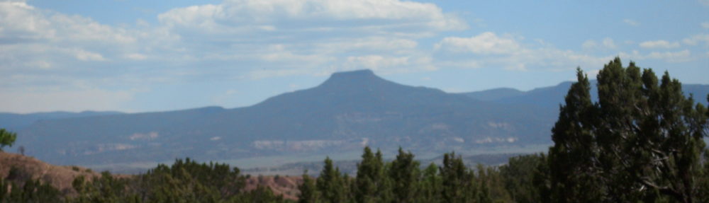
Landscape near Trinidad, Colorado – Panoramio image courtesy Slakingfool – http://www.panoramio.com/photo/31935674

UPDATE : A few homes have been damaged during this earthquake. No collapsed homes, but cracks in walls, broken windows, collapsed chimneys, etc.  Earthquake-Report.com labels this as ‘minor damage’

UPDATE : Report from a girl on facebook : My father lives West of Trinidad (epicenter area ER) (Valdez-Segundo area) His chimney collapsed, walls were cracked, dishes broken. Some objects fell off the wall, but luckily everybody is safe.

UPDATE : Colorado State Patrol is reporting there is damage to I25 near mile markers 5 and 8. That is south of Trinidad, near the New Mexico border. Las Animas County reports damage to highway 12.  They also say there is structural damage to some buildings in the area.

to read more, go to:    http://earthquake-report.com/2011/08/23/unusually-strong-earthquake-in-colorado-new-mexico-united-states/

Colorado/New Mexico Shaken by 5.3 Earthquake

Largest Colorado quake since 1973 shakes homes

By STEVEN K. PAULSON, Associated Press – 14 hours ago

DENVER (AP) — The largest earthquake to strike Colorado in almost 40 years shook hundreds of people in the southern part of the state and in northern New Mexico, causing minor damage to a few homes.

The magnitude 5.3 temblor was recorded at about 11:46 p.m. MDT Monday about nine miles southwest of Trinidad, Colo., according to the National Earthquake Information Center in Golden, Colo. That area is near the New Mexico border is and about halfway between Denver and Albuquerque, N.M. The quake followed three smaller ones that hit the area earlier in the day.

U.S. Geological Service geophysicist Shengzao Chen said the information center had received calls from more than 70 people in Trinidad and several dozen people in New Mexico who felt the shaking. More than 30 people in Colorado Springs, Colo., about 130 miles north of Trinidad, also reported feeling the quake, he said.

USGS geophysicist Jessica Sigala said Tuesday that Monday’s earthquake damaged chimneys, cracked walls and knocked items off shelves, but there were no injuries.

A few homes were damaged and there were rockslides on Colorado Highway 12 and Interstate 25, but both highways remained open, a Las Animas County Sheriff’s Office dispatcher said Tuesday.

to read more, go to:    http://www.google.com/hostednews/ap/article/ALeqM5heS7XOwREfIGoPBf5T1o6y0JSjWg?docId=5dd8b5649b844f178a0ba72e2ab2fbf5

More on Irene

Hurricane Irene upgraded to Category Two, TWS projects Category Four in the Bahamas and U.S. Coast

Published on August 22, 2011 5:35 pm PT
– By Jim Duran – Writer
– Article Editor and Approved – Warren Miller


(TheWeatherSpace.com) — Aircraft from NOAA has found 100 mph sustained winds in Irene and TWS Senior Meteorologist Kevin Martin says this will be a Category Three within the next 24 hours.
“I finally have produced an intensity map and will be conservative with a max of Category 4 in-which The Bahamas will see this damaging hurricane on up to my landfall point between Myrtle Beach, South Carolina and Wilmington, North Carolina.” said Martin.

Hurricane Irene is strengthening faster than projections as it moves into warmer waters and misses the Dominican Republic’s 10,000 foot peaks.

Martin says in his latest forecast video that it could end up going to a Category Five but that is not going to be projected for another 24 hours.

All interests from Florida to New England should keep an eye on future updates.

to read more and see the video, go to:    http://www.theweatherspace.com/news/TWS-08_22_2011_irenecattwo.html

Pipes Across the Nation Burst as US Water Infrastructure Rapidly Fails

Hugh Pickens, Slashdot.com contributor, writes:

“Thom Patterson writes that, triggered by this summer’s record high temperatures, hundreds of crucial water pipelines have burst across the nation, temporarily shutting off water to countless consumers just when they need it most — a clear sign that Americans should brace for more water interruptions, accompanied by skyrocketing water bills. “It’s the heat and the high water usage,” says Debbie Ragan of Oklahoma City’s Utilities Department, adding that as days of 100 degree-plus temperatures bake the region, the utility has reported 685 water main breaks since July alone, four times the normal rate. Much of the nation’s underground water lines are 80 to 100 years old — and approaching the end of their lives as the shifting climate brings more droughts, record high temperatures and other weather conditions that will damage water infrastructure.”

Read more with source links.

Tuesday Could Bring Severe Weather

Tuesday could be BIG for Severe Weather

Posted: August 21, 2011 by Storm Central in Uncategorized


Tuesday could lead to interesting day for Severe Weather. With a un seasonal dip in the Jet over the Midwest, we could see a nice severe weather day for portions of the Midwest. As of now, tornadoes don’t look like a huge threat but the chance is a bit higher from previous summer outlooks. States included would be: IL, WIS, Iowa, MN, MO and this outlook below will likely expand. Graphical Updates tomorrow on this situation.
The area below will likely go to a 30% chance by tonight by the SPC.


d


Tornado Devastates Goderich, Ontario

Powerful tornado kills man in Goderich, Ontario

Dozens injured in southwestern Ontario community

The Canadian Press

Posted: Aug 21, 2011 5:01 PM ET

Last Updated: Aug 22, 2011 1:35 AM ET

Read 109comments109

A police officer surveys tornado damage in Goderich, Ont., on Sunday. One man died, dozens were hurt and the community's downtown was devastated.A police officer surveys tornado damage in Goderich, Ont., on Sunday. One man died, dozens were hurt and the community’s downtown was devastated. (Geoff Robins/Canadian Press)

The most powerful tornado to hit the province in years swept through the southwestern Ontario town of Goderich Sunday afternoon, killing one person and devastating the picturesque community on the shores of Lake Huron.

Downtown businesses, century-old buildings and several churches lost their roofs and upper floors as the twister ripped through the town.

Images show downed power lines, trees and debris strewn across streets, while witnesses described cars being picked up and thrown like toys.

for the rest of the story, go to:    http://www.cbc.ca/news/canada/toronto/story/2011/08/21/ontario-weather-watch.html

Irene Set to Ascend the Coast

Long range tracking of Irene has the Carolinas as a landfall point, then New York

Published on August 22, 2011 6:10 am PT
– By Jim Duran – Writer
– Article Editor and Approved – Warren Miller


Click for 8/20/11 Update map

(TheWeatherSpace.com) — Confidence is growing stronger on a landfall point with Hurricane Irene as it leaves Puerto Rico.

It was around this time where TheWeatherSpace.com Senior Meteorologist Kevin Martin went for where Hurricane Earl would be, closer to the North Carolina coast than models had shown.

Now, Martin has released his long range track given where Irene is now and says this is going to be a Major Hurricane.

“The storm will be deadly, likely hitting between Myrtle Beach, South Carolina and Wilmington, North Carolina before heading inland across North Carolina and then hitting Long Island, New York down the line,” said Martin. “The storm is finding a weakness in the ridge with the trough in the area and this is why I am giving it such a sharp northward turn.”

If Martin’s track is correct, Hurricane Irene will be similar to Hurricane Floyd in 1999.

Everyone in the Bahamas needs to prepare now for Hurricane conditions as well as up the Southeastern U.S. coast.

The system will affect more than the coast, it should have Hurricane force winds inland as well when it hits land. Martin’s path brings this to New York as a dying, but still strong storm system.

fr/http://www.theweatherspace.com/news/TWS-08_22_2011_longrangeirene.html

Teleportation of DNA

It’s a great day for ‘Frontier Science’ Research when the Luc Montagnier experiment into teleporting DNA is reported in New Scientist!

12 January 2011 by Andy Coghlan

A Nobel prizewinner is reporting that DNA can be generated from its teleported “quantum imprint”

A STORM of scepticism has greeted experimental results emerging from the lab of a Nobel laureate which, if confirmed, would shake the foundations of several fields of science. “If the results are correct,” says theoretical chemistJeff Reimers of the University of Sydney, Australia, “these would be the most significant experiments performed in the past 90 years, demanding re-evaluation of the whole conceptual framework of modern chemistry.”

Luc Montagnier, who shared the Nobel prize for medicine in 2008 for his part in establishing that HIV causes AIDS, says he has evidence that DNA can send spooky electromagnetic imprints of itself into distant cells and fluids. If that wasn’t heretical enough, he also suggests that enzymes can mistake the ghostly imprints for real DNA, and faithfully copy them to produce the real thing. In effect this would amount to a kind of quantum teleportationMovie Camera of the DNA.

to read more, go to:    http://neshealthblog.wordpress.com/2011/01/17/luc-montagnier-experiment-in-new-scientist/