Aftershocks Hit Virginia

Strong aftershock below Cuckoo and approx. 8 km from Mineral, Virginia

Last update: August 25, 2011 at 6:59 am by By Armand Vervaeck and James Daniell

Earthquake overview : A moderate aftershock has rattled the Virginia earthquake area. We do not expect any additional damage, but based on the Felt reports, the earthquake was felt in a wide area

….

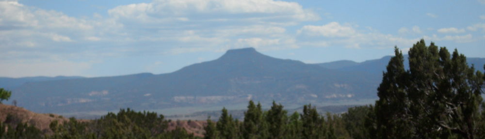
Direct epicenter area from the August 25 aftershock – Panoramio image courtesy: Idawriter

Update : Aftershocks likes this one are perectly normal after a 5.9 earthquake. Occasionally an isolated 5+ quake might be possible too. A greater aftershock than the initial 5.9 is also possible, but thechance on it is very exceptional.

Update : Based on the many Felt reports we are receiving we do expect at max. some additional minimal damage within a radius of 5 km from the epicenter (which means Cuckoo alone).

Update : Epicenter of the earthquake below Cuckoo and approx. 8 km from Mineral

to read more, go to:   http://earthquake-report.com/2011/08/25/strong-aftershock-below-cuckoo-and-approx-8-km-from-mineral-virginia/

Storms and Irene for the East Coast

First severe weather on Thursday, then Irene for the Mid-Atlantic to Northeast

Published on August 24, 2011 10:55 pm PT
– By Kevin Martin – Senior Meteorologist
– Article Editor and Approved – Ron Jackson


No larger image

(TheWeatherSpace.com) — A frontal zone will come into the Northeastern USA down through the Mid-Atlantic on Thursday afternoon and evening.

This front will bring severe weather with it. Shear values suggest an outlining tornado threat within it and I am watching any need to issue a tornado product but will keep the chances lower for strong tornadoes due to some mid/upper level dynamics that will be lacking.

Still, the main threats will be large hail and damaging winds across the area. TheWeatherSpace.com is monitoring the area and will update on Thursday morning.

Hurricane Irene will hit the Mid-Atlantic to Northeastern USA coast and TWS projections for several days have been farther west than both models and NOAA. This needs to be taken seriously as I issued a Hurricane  Watch on Wednesday morning and the details can be found by Clicking here.

fr/http://www.theweatherspace.com/news/TWS-08_24_2011_midnesvr.html

No Connection with the Quakes

Flurry of Earthquakes in Peru, Virginia & Colorado Not Connected

Natalie Wolchover, Life’s Little Mysteries Staff Writer
Date: 24 August 2011 Time: 05:01 PM ET
Earthquakes in the world in the past 7 days. Credit: USGS
Earthquakes in the world in the past 7 days.
CREDIT: USGS

The magnitude 7.0 earthquake in northern Peru today (Aug. 24) was the third major temblor to shake the Americas in less than 48 hours. A magnitude 5.8 quake hit Virginia yesterday, and a magnitude 5.3 event rumbled under Colorado the day before.

One might naturally wonder if there’s a trend here — if the Peru, Colorado andVirginia earthquakes are connected. But experts say there isn’t, and they aren’t.

“The question comes up all the time,” said David Schwartz, an earthquake geologist with the U.S. Geological Survey (USGS), “but these three earthquakes are completely unrelated.”

to read more, go to:   http://www.livescience.com/15741-flurry-earthquakes-peru-virginia-colorado-connected.html

Magic Hurricane Date?

Hurricane Irene Affirms ‘Magic’ Hurricane Date

by Brett Israel
Date: 23 August 2011 Time: 06:55 PM ET
Hurricane Irene as a Category 2 hurricane on Aug. 23.
CREDIT: NOAA/NASA.

Hurricane watchers circle Aug. 20 on their calendars every year. This is the “magic” date when hurricane season seems to kick into high gear.

Like clockwork, Hurricane Irene — the Atlantic’s first hurricane of 2011 — was born on Aug. 22, later strengthening to a Category 2 hurricane. Last year was another good example of an active storm season ramping up after Aug. 20. All of the 2010’s major hurricanes (those of Category 3 or higher) formed after Aug. 20, starting with Danielle on Aug. 21.

Aug. 20 seems to be special because around this time, the air and ocean are in just the right state to foster and feed the monster storms. In climate-speak, this time of year is when vertical shear (a change in wind directions with height) in the atmosphere is low enough and sea surface temperatures are warm enough to create big storms.

to read more, go to:    http://www.livescience.com/15717-hurricane-irene-august-20.html

Northern California Quakes

California Earthquakes: Twin Shocks Jolt Nothern California

08/24/11 09:04 AM ET   AP

MAMMOTH LAKES, Calif. — While the East Coast recovers from earthquake jitters, small quakes have been rocking California.

The U.S. Geological Survey says in a computer-generated report that the latest was a magnitude-4.4 quake that struck at 4:59 a.m. Wednesday about nine miles southeast of Mammoth Lakes.

A Mono County sheriff’s dispatcher who didn’t give her name says there were a couple of “just wondering” calls but no reports of damage.

There was a magnitude-3.6 quake centered six miles southeast of Oakland at 11:36 p.m. Tuesday.

That shaker was felt by people throughout the San Francisco Bay area, but there are no reports of damage.

fr/http://www.huffingtonpost.com/2011/08/24/california-earthquakes-twin-shocks-bay-area_n_935154.html

NYPD CIA Anti-Terror Activities

NYPD CIA Anti-Terror Operations Conducted In Secret For Years

Nypd Cia Terrorism Spying

By MATT APUZZO and ADAM GOLDMAN   08/24/11 06:10 AM ET   AP

NEW YORK — In New Brunswick, N.J., a building superintendent opened the door to apartment No. 1076 one balmy Tuesday and discovered an alarming scene: terrorist literature strewn about the table and computer and surveillance equipment set up in the next room.

The panicked superintendent dialed 911, sending police and the FBI rushing to the building near Rutgers University on the afternoon of June 2, 2009. What they found in that first-floor apartment, however, was not a terrorist hideout but a command center set up by a secret team of New York Police Department intelligence officers.

From that apartment, about an hour outside the department’s jurisdiction, the NYPD had been staging undercover operations and conducting surveillance throughout New Jersey. Neither the FBI nor the local police had any idea.

Since the terrorist attacks of Sept. 11, 2001, the NYPD has become one of the country’s most aggressive domestic intelligence agencies. A months-long investigation by The Associated Press has revealed that the NYPD operates far outside its borders and targets ethnic communities in ways that would run afoul of civil liberties rules if practiced by the federal government. And it does so with unprecedented help from the CIA in a partnership that has blurred the bright line between foreign and domestic spying.

Neither the city council, which finances the department, nor the federal government, which contributes hundreds of millions of dollars each year, is told exactly what’s going on.

to read more, go to:    http://www.huffingtonpost.com/2011/08/24/nypd-cia-terrorism_n_934923.html

Visuals: Recent Earthquake & Volcanic Activity

8/24/2011 — Global Earthquake and Volcano overview and a CRATON representation for comparison

Posted on August 24, 2011 by dutchsinse
Compare the map of the craton to the current chart of earthquakes shown laid out on the 3D map of EQ3D….. (more here: about the craton)       Here is a shot of the activity over the past two weeks around the pacific ring of fire : to read more and see an image of this very interesting activity in the Ring of Fire, go to:     http://www.dutchsinse.com/blog/

Earthquake Report 8/24/11


Update time = Wed Aug 24 15:00:01 UTC 2011

fr/http://earthquake.usgs.gov/earthquakes/recenteqsww/Quakes/quakes_all.php


MAG UTC DATE-TIME
y/m/d h:m:s
LAT
deg
LON
deg
DEPTH
km
 Region
MAP  5.0   2011/08/23 19:53:30  -21.740  -176.850 198.6  FIJI REGION
MAP  5.2   2011/08/23 19:29:53   -5.880   147.476 30.8  EASTERN NEW GUINEA REG, PAPUA NEW GUINEA
MAP  4.8   2011/08/23 19:01:51   1.234   120.497 44.9  MINAHASA, SULAWESI, INDONESIA
MAP  2.8 2011/08/23 18:46:50   37.931   -77.935 0.1  VIRGINIA
MAP  5.8   2011/08/23 17:51:05   37.936   -77.933 6.0  VIRGINIA
MAP  4.7   2011/08/23 16:52:05   6.704   -73.039 161.0  NORTHERN COLOMBIA
MAP  3.7 2011/08/23 15:34:25   59.074  -151.094 37.1  KENAI PENINSULA, ALASKA
MAP  4.8   2011/08/23 14:28:56   36.475   71.236 75.0  HINDU KUSH REGION, AFGHANISTAN
MAP  3.9 2011/08/23 14:11:13   37.032  -104.690 5.0  COLORADO
MAP  2.6 2011/08/23 12:03:56   37.055  -104.761 5.0  COLORADO
MAP  3.2 2011/08/23 11:34:56   67.968  -146.118 14.6  NORTHERN ALASKA
MAP  3.2 2011/08/23 09:37:58   37.099  -104.711 5.0  COLORADO
MAP  2.5 2011/08/23 09:32:22   37.248  -104.705 5.0  COLORADO
MAP  2.5 2011/08/23 09:07:35   32.229  -115.353 12.1  BAJA CALIFORNIA, MEXICO
MAP  3.8 2011/08/23 07:17:59   37.099  -104.610 4.8  COLORADO
MAP  3.0 2011/08/23 07:16:13   39.273  -118.108 10.3  NEVADA
MAP  3.2 2011/08/23 07:01:35   37.109  -104.550 5.0  COLORADO
MAP  3.5 2011/08/23 06:56:59   37.110  -104.722 5.0  COLORADO
MAP  4.8   2011/08/23 06:04:56   42.100   142.480 45.6  HOKKAIDO, JAPAN REGION
MAP  5.3   2011/08/23 05:46:19   37.070  -104.700 4.0  COLORADO
MAP  4.9   2011/08/23 04:56:53   12.010   44.041 10.1  NEAR THE COAST OF YEMEN
MAP  3.6 2011/08/23 04:49:18   19.128   -64.403 68.7  VIRGIN ISLANDS REGION
MAP  4.4 2011/08/23 03:55:57   14.321   -90.055 21.6  GUATEMALA
MAP  4.9   2011/08/23 03:20:02  -56.172   -27.076 110.1  SOUTH SANDWICH ISLANDS REGION
MAP  2.9 2011/08/23 03:11:00   59.340  -152.672 75.5  SOUTHERN ALASKA
MAP  3.0 2011/08/23 02:48:52   37.056  -104.726 5.0  COLORADO
MAP  5.1   2011/08/23 01:23:00   33.155   76.839 41.6  KASHMIR-INDIA BORDER REGION
MAP  2.5 2011/08/23 00:45:48   32.541  -115.720 1.9  BAJA CALIFORNIA, MEXICO
MAP  4.6   2011/08/23 00:41:15  -22.071  -179.193 519.8  SOUTH OF THE FIJI ISLANDS

Update on Irene

urricane Irene Approaches the Bahamas
Posted by: JeffMasters, 7:42 AM GMT on August 24, 2011 +9
As of 2AM EDT, Hurricane Irene was located at 21.3N, 72.6W, 400 miles southeast of Nassau. It was moving west-northwest at 9 mph with maximum sustained winds of 100 mph, making it a Category 2 storm on the Saffir-Simpson scale. Irene has a minimum central pressure of 966 mb. Hurricane warnings have been issued for all of the Bahamas and the Turks and Caicos Islands. Tropical storm warnings are in effect for Haiti from Le Mole St. Nicholas to the Dominican Republic border.

Satellite Views
Figure 1 shows that Irene has a large eye visible in infrared imagery, (26 miles across accoring to a report from the Hurricane Hunters at 130AM) with well-defined outflow cirrus bands. Tuesday evening, TRMM, NASA’s tropical research satellite, flew directly overhead Irene, getting a radar scan of the storm using it’s downward pointing radar, shown in Figure 2. It is immediately apparent that Irene has well-developed bands of rain showers, with strong storms present in the eyewall.


Figure 1 IR satellite view of Irene taken at 113AM EDT, August 23, 2011

On Inner Wisdom

May Benatar, Ph.D., L.C.S.W.
May Benatar, Ph.D., L.C.S.W.     May Benatar is a licensed clinical social worker in practice as a psychotherapist in the D.C. metro area. She has her Ph.D. in clinical social work and has published, taught and consulted on the topics of adult development, parenting and the treatment of the long-term effects of psychological trauma.

Consult Your Inner Wisdom: It Has All the Answers

Posted: 8/20/11 11:17 AM ET

In recent years, I have experimented with a therapeutic technique that I cribbed from clinician/writer Sarah Krakauer. I found it useful both for my clients and for myself. I share it here.

The idea is simple: At bottom, no matter how fractured our identity, or sense of self, there is within us a wholeness and a wisdom that we can consult as a sort of inner gyroscope. The theory goes that there is a unity within, and if we can gain access we can find a treasure trove of wise guidance

to read more, go to:  http://www.huffingtonpost.com/may-benatar-phd-lcsw/consult-inner-wisdom_b_931374.html